Discover how the Mason-Arenac Line divides Michigan’s north and south, why it matters for land management, and explore the unique recreation areas like Waterloo-Pinckney, Island Lake, and Brighton in the southern Lower Peninsula.
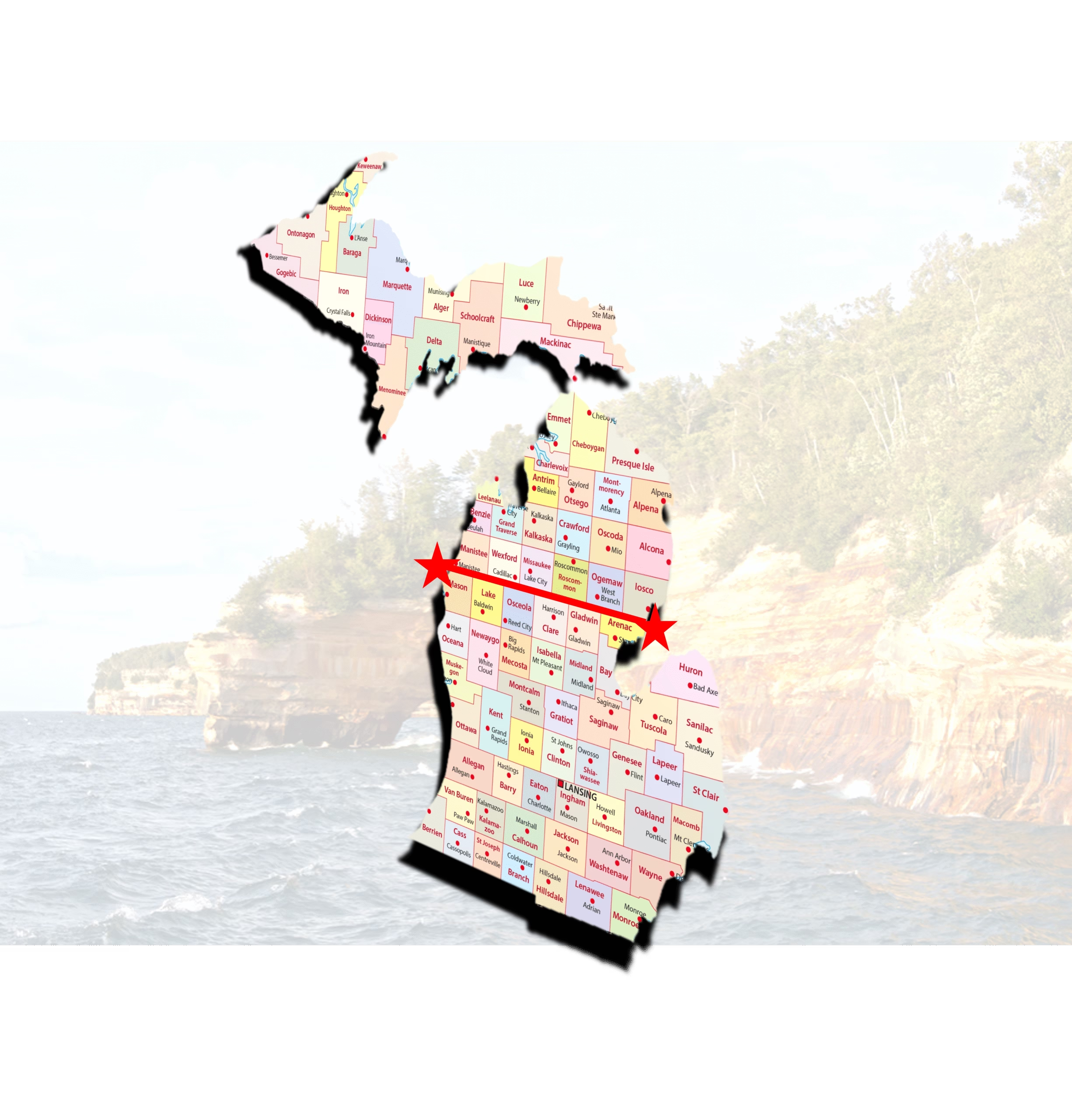
Ask ten Michiganders where “Up North” begins, and you’ll likely get ten different answers. Some say it’s the Mackinac Bridge. Others argue for Clare, Grayling or Cadillac. While it’s a subject of debate for most of us, hardly anyone knows that the Department of Natural Resources officially settled the argument more than three decades ago with the establishment of the Mason-Arenac Line.
This invisible boundary, stretching across the Lower Peninsula along the northern edges of Mason, Lake, Osceola, Clare, Gladwin, and Arenac counties, has quietly shaped how Michigan manages its public lands for decades. It even helps explain why the Waterloo-Pinckney Recreation Areas, right here in our own backyard, feel so different from the sprawling state forests farther north.
Drawing the Line Between “Up North” and Down Here
The Mason-Arenac Line wasn’t drawn by ancient settlers or determined by some long-lost map. It was created in 1994 as part of Michigan’s Natural Resources and Environmental Protection Act (NREPA), a law aimed at organizing land management and conservation across the state. The line gives the Michigan Department of Natural Resources (DNR) a practical way to divide the state’s vastly different landscapes:
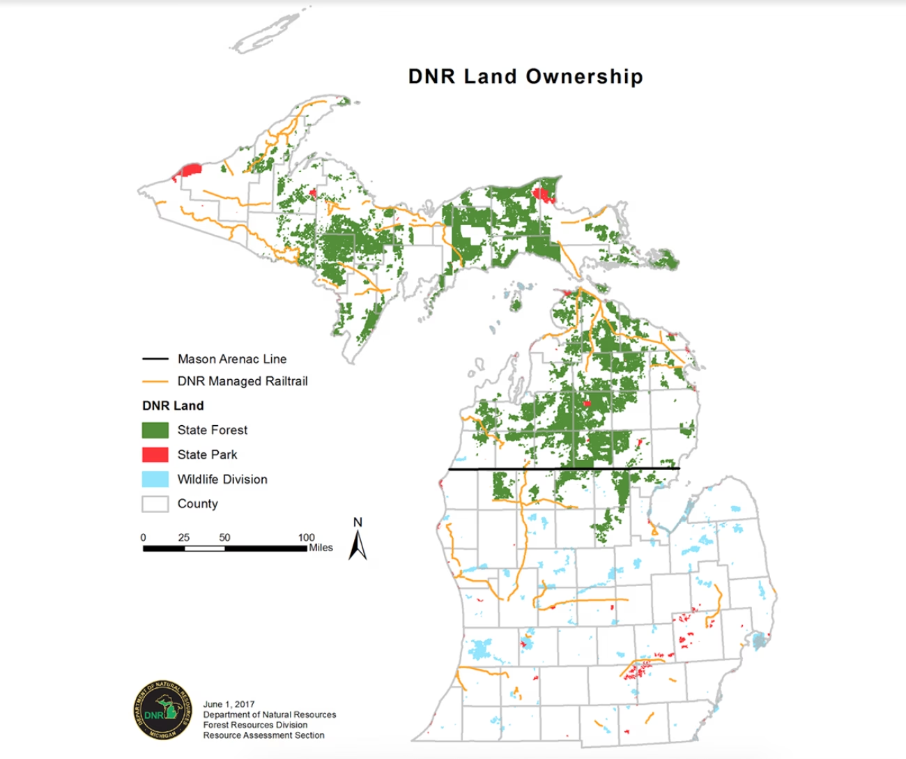
- North of the Mason-Arenac Line: Around 3.86 million acres of state-managed land, most of it vast forests and wildlands – think state forests and the Upper Peninsula.
- South of the Line: A much smaller 733,000 acres, mostly fragmented parcels like state game areas and recreation sites woven into farmland, towns, and cities.
It’s not a cultural divide, per se, but it sure influences how we think about Michigan. If you grew up hearing “Up North” meant a cabin on a lake, you’re probably picturing the lands north of that line. And while the Upper Peninsula (U.P.) is undeniably farther north, it’s in a league of its own, geographically, culturally, and in the hearts of Yoopers. No one in the U.P. calls it “Northern Michigan.” It’s simply “The U.P.”
Difference in DNR Management
Land below the Mason-Arenac Line, in Michigan’s southern Lower Peninsula, is managed primarily for recreation in smaller, fragmented parcels, such as state parks, state game areas, and recreation areas. These lands are geared toward day-use activities, like hiking, fishing, hunting, and picnicking, and they often sit near developed or agricultural areas.
In contrast, land above the Mason-Arenac Line, in Michigan’s northern Lower Peninsula and Upper Peninsula, is managed as vast, contiguous blocks of state forest, focused on resource management (like timber production), habitat conservation, and backcountry recreation such as camping, hunting, and trail use. These areas are less developed, with fewer campgrounds and facilities, emphasizing a more rugged, wilderness experience.
Waterloo-Pinckney is Big, Beautiful, and a Whole Different Kind of Wild
So, where does that leave us, here in southern Michigan? While we don’t have the endless forests of the north, we do have something unique. While only a fraction of the size of the state forests and Porcupine Mountains State Park, the Waterloo-Pinckney Recreation Areas form 32,000 acres of the largest contiguous block of state-owned land in all of Michigan, specifically designed for recreational use. Add in Island Lake and Brighton recreation areas for an astounding network of state-managed lands in southeast Michigan that together offer a wide variety of outdoor experiences for anyone who loves to hike, bike, camp, swim, fish, paddle, or simply get outside and enjoy nature.
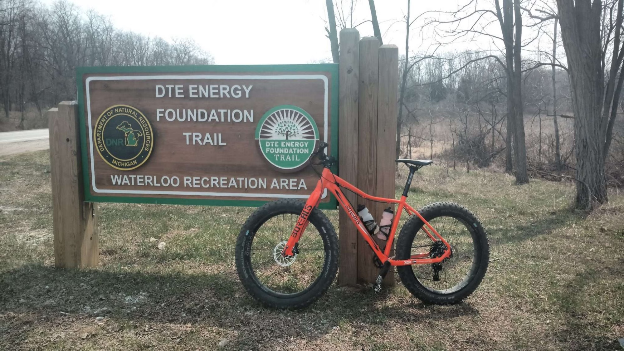
- Waterloo Recreation Area: Sprawling across more than 21,000 acres in Jackson and Washtenaw counties, it’s a haven for hiking, camping, paddling, and horseback riding.
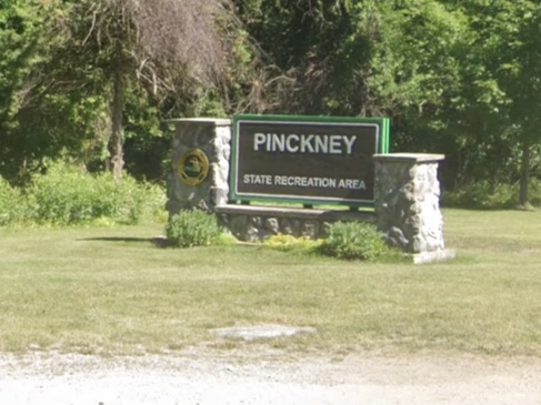
- Pinckney Recreation Area: Covering 11,000 acres in Livingston and Washtenaw counties, it’s known for its hilly terrain, kettle lakes, and popular trails like the Potawatomi. It is connected with Waterloo by the 35-mile Waterloo-Pinckney Trail.
- Island Lake Recreation Area: With about 4,000 acres in Livingston County, it features four inland lakes, the Huron River, meadows, mature hardwood forests, mountain biking trails, paddling opportunities, hiking, swimming, a modern shooting range, and even a hot air balloon launch area.
- Brighton Recreational Area: Laid out in almost 5,000 acres in Livingston County, it offers nine lakes, five campgrounds, a designated swim beach, boating access sites, picnic areas, a disc golf course, and a 35-mile trail system open to horseback riding, mountain biking, hiking, and more.
Together, these two areas form 41,000 acres of state-managed land of pure Michigan beauty. That’s a big deal, because unlike the state forests up north, the recreation areas down here are designed for people, with campgrounds, beaches, picnic spots, and trailheads. They’re not just managed for timber or wildlife habitat; they’re meant for recreation and adventure.
Sidebar: Mason-Arenac vs. Mason-Dixon
While the Mason-Arenac Line and the Mason-Dixon Line both divide regions into “north” and “south,” and sound the same, that’s where the similarities end. The Mason-Dixon Line, drawn in the 1760s, became a defining symbol of America’s deep historical, cultural, and political divisions, especially during the era of slavery and the Civil War.
In contrast, Michigan’s Mason-Arenac Line, established in 1994, is a purely administrative tool used by the Department of Natural Resources to manage state-owned lands and natural resources. One line shaped a nation’s identity. The other helps decide where you can hunt, camp, and hike. While the Mason-Arenac Line lacks the cultural weight of the Mason-Dixon, it still quietly influences how we experience Michigan’s great outdoors.
So… Where’s “Up North” in Michigan?
Here’s the fun part: There’s no official definition. If you’re standing in Waterloo-Pinckney, you’re still very much in southern Michigan. Head north across the Mason-Arenac Line, and you’re in what the state calls “Northern Michigan.” Cross the Mackinac Bridge, and you’re in the U.P., a place all its own.
No matter where you are, Michigan’s diverse landscapes offer something special. So, whether you’re chasing waterfalls in the U.P., hiking the Waterloo-Pinckney Trail, or camping deep in the woods of the Mackinaw State Forest, you’re part of the rich, layered story of this state we call home.
Sources:
- Michigan Department of Natural Resources (DNR) – Public Land Acreage Report
- Natural Resources and Environmental Protection Act of 1994 (NREPA) – Michigan Legislature
- Michigan DNR – Pinckney, Waterloo, Island Lake, and Brighton Recreation areas


 8123 Main St Suite 200 Dexter, MI 48130